
PVdesign - solar power plant design software
PVdesign is an app to simulate solar irradiance and PV system yield for any location in Europe. It is based on average monthly irradiance and temperature data from the ERA5 database (2010-2020) or Slovenian databases (ARSO and Solar irradiance in Slovenia 1990-2000). The PVgis database is used to simulate the horizon and altitude data at the selected location. The application uses UTC+1 time (CET without daylight saving time changes). The spatial resolution of the ERA5 database is approximately 9 km, while the Slovenian database uses a spatial resolution of 1 km. It works in the Android environment. The app allowd to define/measure the orientation and inclination of the modules. For shading infuences, a utility has been added to determine the horizon using the camera.
A basic (Lite) and a full version are available. The basic version is based on a monthly calculation of the irradiation and yield of the module and is intended for anyone who wants to check the irradiation and expected yield of a solar power plant at their location. The shading profile tool in the Lite version is a testing tool only; the horizon is not taken into account in the calculations. It only works in Slovenia.
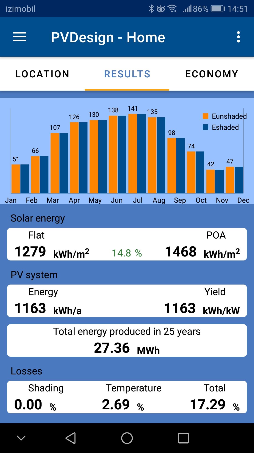
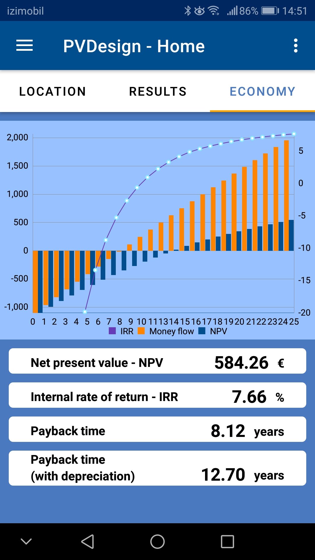
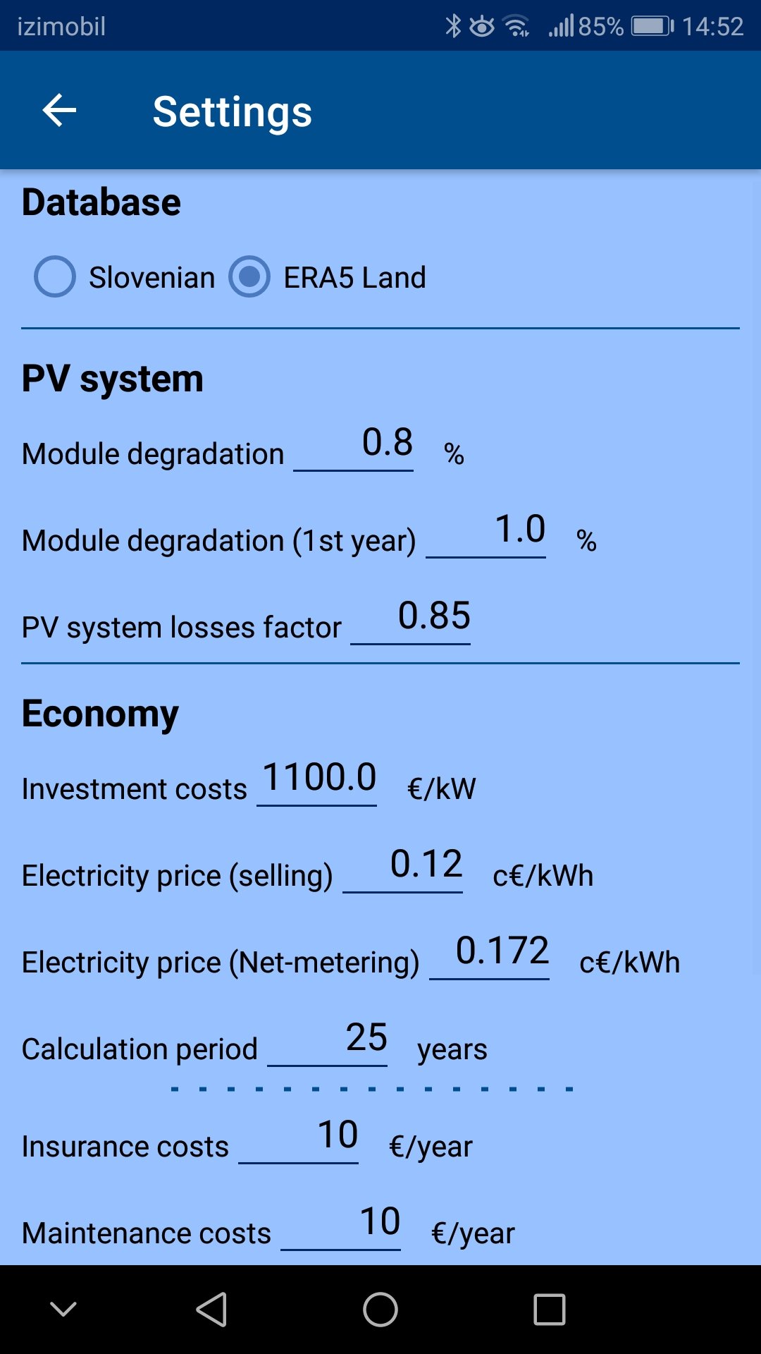
The full version uses an hourly method to calculate the solar irradiation and energy yield of a PV system. It uses the Slovenian database and the ERA5 base for the calculation. In addition to a more detailed analysis with shading impacts, it also offers a detailed economic analysis of the investment. The shading impact can be calculated in relation to the surrounding terrain or the included utility can be used to record the profile of the surroundings.
The app is available on the Google play store.
User manual
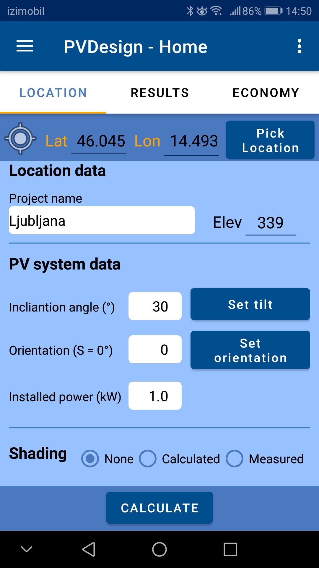
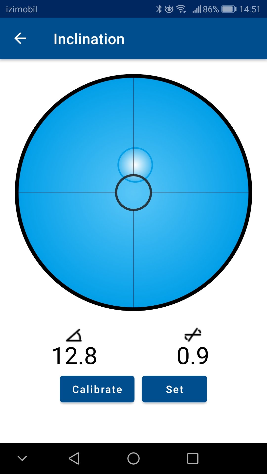
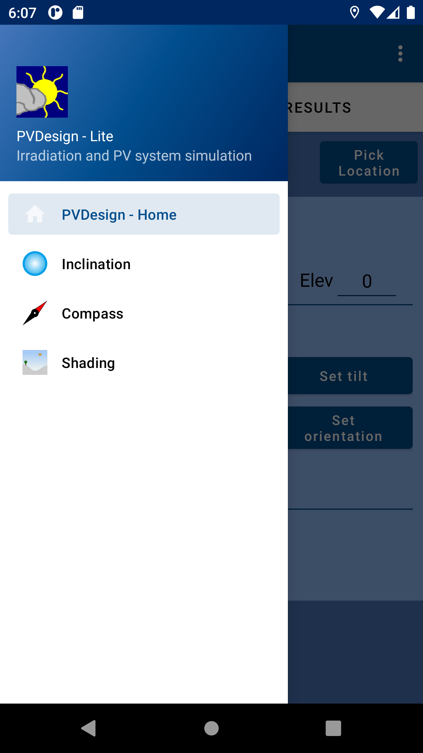
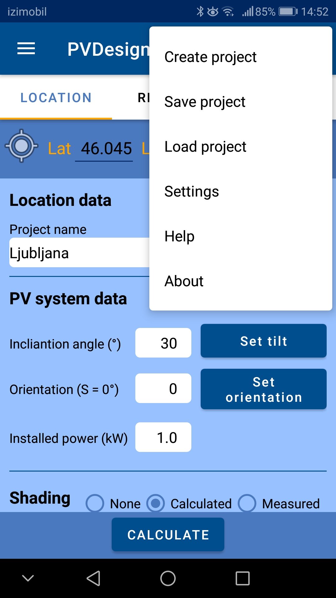
On the home page, you enter basic information about the location of the power plant and use the Calculate button to calculate the yield of the solar power plant. To determine the inclination, orientation and horizon, the phone needs to be calibrated. To calibrate the sensors, follow the general calibration instructions (rotate the phone around all three axes).
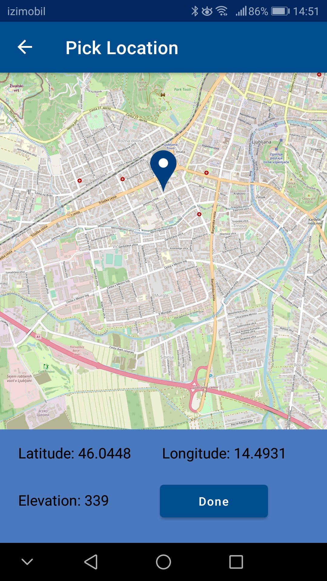
Location: The location of your device is read when you start the application. In case the GPS location is not known or the GPS sensor has not been buried, you can enter the current location manually or after successful geolocation of the phone by pressing the button
You can specify an arbitrary location by using the map.
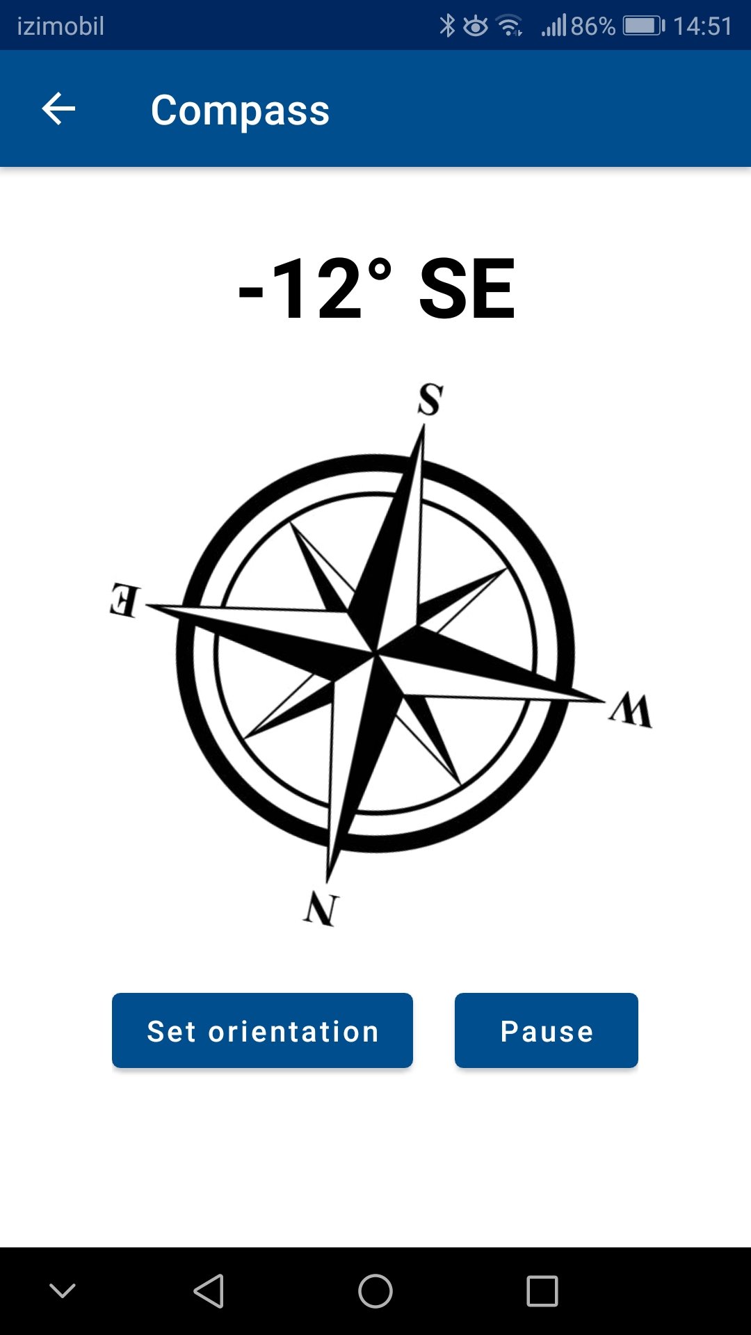
Orientation: Start the compass, turn the phone in the direction the modules will face and set the orientation.
Setting the inclination: Start the spirit level, place the mobile phone on the roof or on the surface where the modules will be located and set the inclination.
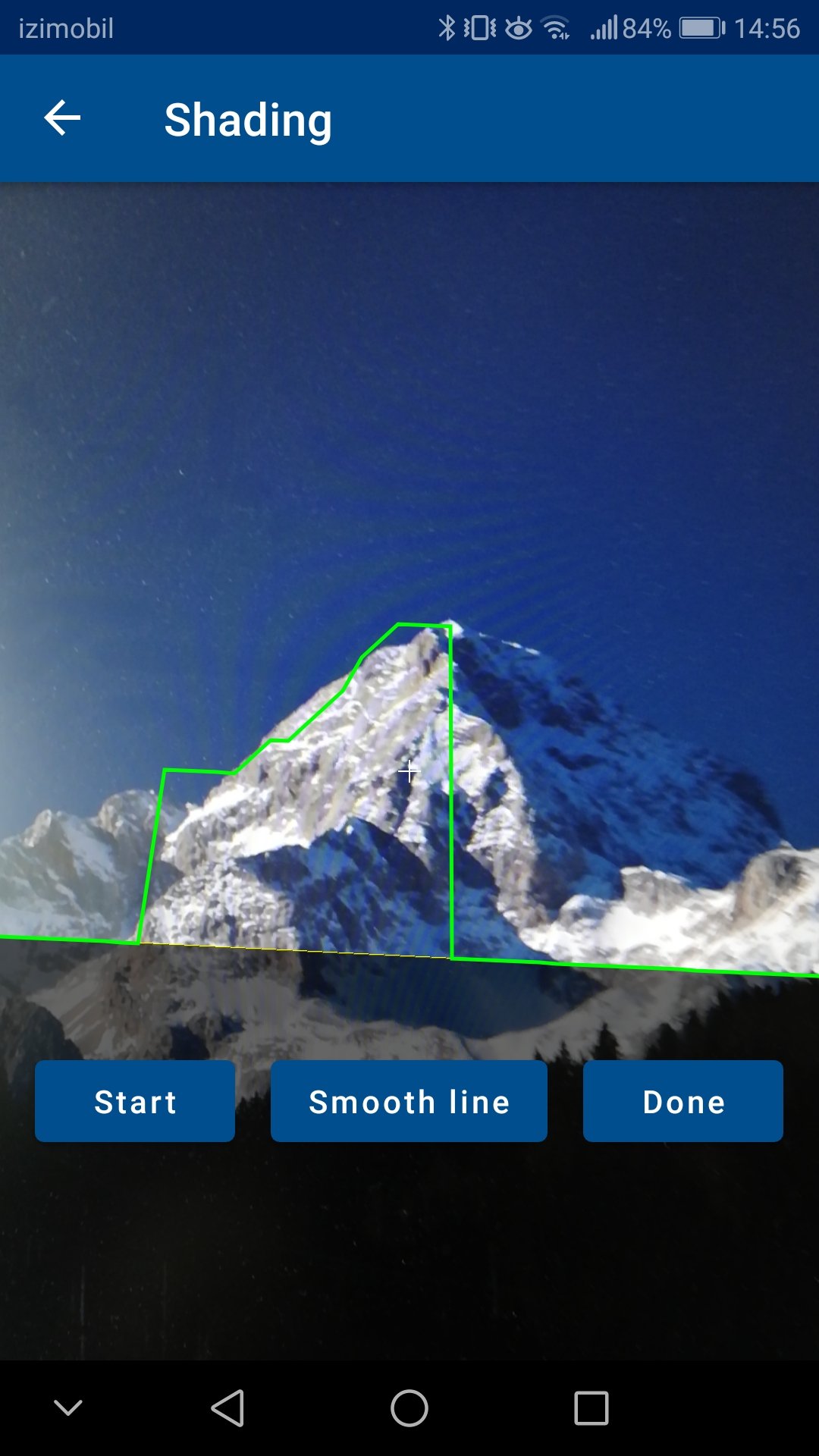
Shading: Start the horizon tool. Press the start button on the screen and start recording the horizon by moving around its axis. The horizon is recorded by tracing the crosshairs in the centre of the screen to the obstacles shown by the camera.
Report: The results can be exported to a PDF report. Sample report can be found here ![]()
The app is available in English and Slovenian language, depending on your phone settings..
Privacy Statement
PVdesign uses your phone's location and camera data. The location data is used for calculation purposes only and is not forwarded. The camera does not store images and is only used as a background (preview) when recording the horizon.